 Saturday, August 19th 2017
5:29AM
I suddenly realize I rely on my phone too much. How am I to tell time without one? Normally in the wilderness I don’t even worry about the time, just daylight and no daylight, but this time is different. I want to be sure I am where I want to be by the time the eclipse occurs on Monday. I need a wristwatch. I need to check the oil in my Jeep. Most importantly, I need coffee.
6:25AM
I’m at the Waffle House outside Alcoa, TN. Typical old ladies working at a diner. The cook doesn’t wash his hands, and the food is cold. A poor girl with a pretty smile comes in as I am leaving. The clouds on the horizon are turning orange, yellow, and red as the sun rises. No longer can I see the bright sliver of a crescent moon. It’s almost a new moon! What planet is that, anyway?
I think the crap at the diner is making me sick. I pick up some diarrhea medicine along with some motor oil and a cheap wristwatch then head south down highway 411. Listening to that good old morning concert on the radio, the road is flat and smooth. Its not long before I cross over water and see a sign, “Welcome to Monroe County & Cherokee National Forest.”
A left in Vonore down the Unicoi Turnpike takes me toward Tellico Plains. The Unicoi Turnpike, also known as highway 360, is named after the historical Unicoi Trail which connected the Overhill Cherokee to the southern villages, and became a primary route for early settlers when establishing trade with the Cherokee. (You know, before the genocide.) The Unicoi Turnpike takes you past Fort Loudon and the Sequoyah Birthplace Museum. The scenery is starting to get serenely vibrant. The sun and I are both getting high, this is a perfect road for a stick of tea. I’m in an area that reminds me of home. A place where people wave to each other as they pass, and you do not even have to prepay for gas. There are a million people on the roads today, but I am cruising on an open road… not a soul.
8:06AM
I have reached Tellico Plains, and from here I will head east on the Cherohala Skyway (165). The Skyway is a scenic highway that connects Tellico Plains, TN with Robinsville, NC. There are no gas stations, but plenty of pull-offs with scenic views, picnic areas, and trailheads. There are even little plaques with historical tidbits of information. Like the first one I come across, overlooking the gully with the Tellico River and the Tellico District Ranger Station. Apparently the station used to be Camp Wickasaw, the first Civilian Conservation Corps camp in the state of Tennessee. It was built in 1933 as part of Roosevelt’s New Deal legislation, putting men to work revitalizing forests and infrastructure by building roads, trails, dams, bridges, and monuments. This was all accomplished in a effort to save the economy during the Great Depression. Of course, these projects were halted to pursue the war efforts of the 1940’s.
Unfortunately, the Skyway is attractive to a lot of motorcycle tourists. They travel in groups, cause noise pollution, and are hazardous to say the least. Many of the local businesses cater to these groups, but once I get away from the Skyway I typically only find hunters and anglers. Bear and turkey are popular game during the season which lasts from October to December, and the Tellico River is stocked with trout from a hatchery upstream near the border. I find out later, however, that the Citico Creek Wilderness is actually one of six designated bear reserves in Tennessee, meaning hunters are not allowed to hunt for bear here.
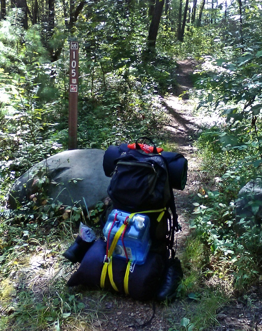
This time I follow the Skyway to Indian Boundary Road. Its north in the middle of a hairpin curve off the Skyway, and there is plenty of signage for Indian Boundary Lake, though not much for Citico Creek Wilderness. Finally leaving the pavement behind, I turn right down 35-1 and drive for about two and half miles before reaching the trailhead. There is a small pull-off to the right just before the T in the road at Warden Fields.
9:08AM
I made it! Well, the driving portion anyways. The sign for trailhead 105 is easy to spot from the road and is guarded by two tiny boulders. There are people fishing off the creek crossing nearby, but hopefully I will have the trail to myself.